See what the world is telling you before the signal becomes an event.
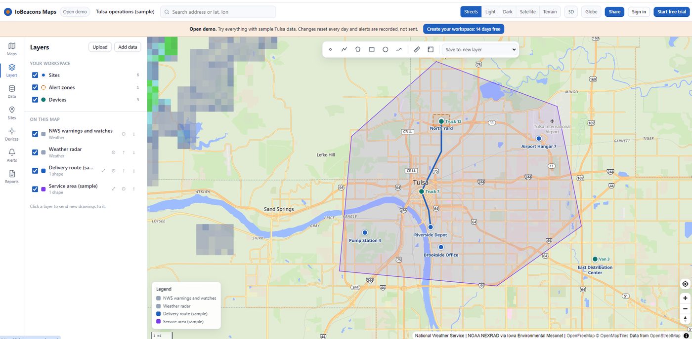
IoBeacons puts your sites, vehicles, sensors, weather, hazards and satellites on one live map. You see what is happening, get told when something changes, and share it with the people who need it. Our team helps you set it up and grow it.
From the street to orbit, on the same map.
Everything below is one product. Switch views with a click and your data comes with you.
Maps
Build maps from your own files and live data. Draw, style, upload, share and embed.
Explore Maps3D
Tilt into terrain and buildings to understand a site before you go there.
Open in 3DGlobe
Zoom out to the whole Earth to follow weather, hazards and routes across regions.
Open the globeSpace
Track live satellites, see their orbits and know what is overhead your sites.
Explore SpaceWatch, get alerted, act, report.
IoBeacons is built for teams who look after real places and moving things: depots, pump stations, fleets, land, buildings and field crews.
- Watch your sites with live weather radar, NWS warnings, earthquakes, wildfires and flood zones layered on top.
- Track vehicles, phones and sensors, with their trail and last known position.
- Get alerted by email, text or webhook when a device enters a zone or a warning touches a site.
- Report on any site in one click and share a PDF or a live link.
From first look to your own workspace.
You can go at your own pace. Nothing below needs a call, but we are here if you want one.
Try the demo
Open a working map with sample data. Click around, draw, switch to 3D or Space.
Open the demo →Start a free trial
Create your own workspace with an email and password. 7 days, everything included.
Create a workspace →Bring your data
Upload spreadsheets, KML, GPX, GeoJSON or shapefiles. Add live layers from the catalog.
What you can upload →Connect and alert
Connect trackers and sensors, draw zones and choose who gets told.
Connect devices →Grow with us
Invite your team, pick a plan, or have us build a custom map, feed or integration.
Talk to us →Companies we support.
The IoBeacons technical team anchors these ventures with mapping, data and engineering.
CO-SYNE
A collaboration platform for teams who need to talk, share and coordinate in real time.
Read more Real estateUSLand.com
A commercial real estate marketplace where location and land data come first.
Read more RecordsResidentData.ai
Home history records that help people understand a property before they commit.
Read moreAn API for everything
Maps, devices, alerts, reports, satellites and weather from code, with JavaScript and Python libraries.
Developer docsData with its source attached
Every layer says where it came from and how fresh it is, so you can cite it and trust it.
ResearchPrivate by default
Your workspace is yours. Share links are opt-in, and you can turn them off at any time.
How we handle dataSee it on your own map.
Open the live demo in your browser. No sign-up needed. When you are ready, start a 7-day free trial or talk to our team about a project.
Off the map.
We couldn't find that page. It may have moved when we rebuilt the site.